Gold at Berringa was first discovered around 1850’s as alluvial gold in gullies and water courses. Hard rock mining followed in 1864. Five major hard rock mining operations were established at Berringa: Birthday Tunnel, Kangaroo, William Fancy, Birthday and South Birthday. Mining exceeded 300m below surface on some levels. These operations were successfully worked up to the start of the First World War, 1914.
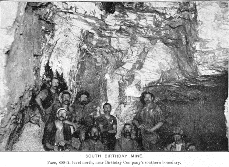
Figure 1. Miners of the South Birthday Mine 1904.
The 1930s saw a rise to gold mining throughout Victoria including a focus on Berringa up to the 1950s. However, on multiple occasions, bushfires in the area caused burning to the shafts ceasing operations.
Once again, operations restarted in mid 1970s as the Berringa Syndicate before a declining Gold Price in the early 1980s caused an end to the latest endeavour. In 1984 the head frame was removed and by 1985 all mining was abandoned. In total around 293,000 ounces of gold was recovered at an average grade of 9.8g/t.
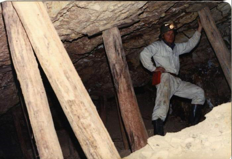
Figure 2. Miner of the Berringa Syndicate Mine 1978.
The Gold of the Berringa Goldfield is hosted in a sequence of Sandstone – Siltstone metasediments tightly folded in a north-south trending orientation. Gold bearing fluids flow up fault systems which brittlely break and crack the metasediments. The remnants of these fault systems are the quartz veins. The gold tends to be deposited on areas where these fault systems intersect the crests and troughs of the folded metasediments.
The interactions of the faults and folds can cause a subdivision of the structurally controlled gold-quartz lodes into three categories: Saddle Reefs, fault reefs and spurs. Looking for these styles of gold mineralisation deeper below previous historic mining is the pathway for modern exploration.

Figure 1. Typical styles of Gold Mineralisation across Victoria.
